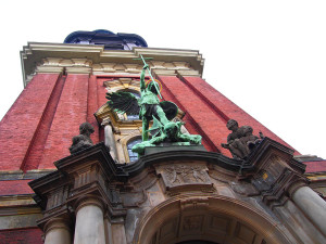
My Swiss group was more punctual than the Germans at the ZOB, our meeting point, on Tuesday morning. We were able to start accordingly, but the traffic held us up a bit. After driving around the Outer Alster through one of Hamburg’s posh districts and getting to know street names such as “Bellevue” and “Schöne Aussicht”, we were able to marvel at the Michel (official name: St. Michaelis) from the inside. Directly from this holy city, we then drove along the “Sinful Mile”, the Reeperbahn, the former no man’s land between Hamburg and Altona, which is now called the “Kiez” by the people of Hamburg. A short drive through Große Freiheit gave us a glimpse of what the evening would bring. Down to the harbor, past the fish market, we passed Blohm + Voss, Hamburg’s largest employer in the port, the second largest port in Europe.
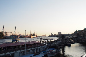
The fact that this port has to contend with the tidal range of around 3.60 m is also evident from the Landungsbrücken, which we saw shortly afterwards on the right-hand side behind the Old Elbe Tunnel. On the left is Hamburg’s oldest subway railroad (also known as the elevated railroad due to its above-ground route), on the right the museum ships Rickmer Rickmers and Cap San Diego. We cross the Niederbaumbrücke bridge and enter the Speicherstadt warehouse district. Here at the western end, you don’t yet recognize much of the freshly baked UNESCO World Heritage Site, only when we drove east between the “old” Speicherstadt and the “hypermodern” HafenCity did the old warehouses from the end of the 19th century appear. But HafenCity with its various buildings is also an eye-catcher. Elphi (official name: Elbphilharmonie), Cruise Terminal, Marco Polo Tower; the new district will be extended eastwards to the Elbe bridges by 2025. Passing the Deichtorhallen, we then came to the Mö (official name: Mönckebergstraße), Hamburg’s busiest shopping street, and the nucleus of Hamburg. Where the town’s first chapel stood in the 9th century, St. Peter’s Church now stands, steadfastly enduring the hustle and bustle around it. We parked in front of the town hall, which was completed at the end of the 19th century after around 50 years of construction, after the old one had been blown up in the Great Fire of 1842. With its market and arcades, the town center was intended to bring a little Italian flair to northern Germany. Our morning tour ended here and everyone went their separate ways… until…
… we met again at the Landungsbrücken in the evening to take a closer look at the Reeperbahn. After climbing Hamburg’s highest “inner city mountain”, we rested for a while in front of the Bernhardt Nocht Institute for Tropical Medicine, the world-famous tropical institute. Here my guests heard the first information about the Reeperbahn, prostitution and the contrast between Hamburg and Altona. Through Davidstraße, we also passed Herbertstraße, which is “forbidden” for women, and then arrived at Davidwache, the main guardhouse of the Reeperbahn. From there, we took a short detour into one of the side streets, which are now frequently used by Hamburgers to avoid the approx. 200,000 visitors at the weekend. On the “back” of Grosse Freiheit, we stopped briefly at the former Israelite Hospital and then entered Grosse Freiheit from the north. We took another look at the St. Josef Catholic Church and the former Star Club before deciding to have a drink in the Olivia Jones Bar next door. It had to be a Hamburg original: Helbings Kümmel. And then the lovely trip was already over… I said goodbye to you on the bus and hope that you will come back – to the most beautiful city in the world!


